We did it! And it only took about three hours! Ha! Take that, post second day low self esteem! Alana had wanted to get up a bit earlier than day three, but we slept through her alarm. It was almost 9:00 by the time I woke up and started preparing breakfast. I thought about giving Alana a shake since she had wanted to be up early, but that was dangerous territory. I decided to just increase the volume of my breakfast making in order to wake her more naturally.

The camp site was nice and shady, so the inside of the tent didn’t heat up as much as usual. Normally its not long after sunrise that the tent gets so hot that I start sweating in my sleeping bag. So we didn’t get up as early as we wanted, but we had a more pleasurable wake up experience than usual.

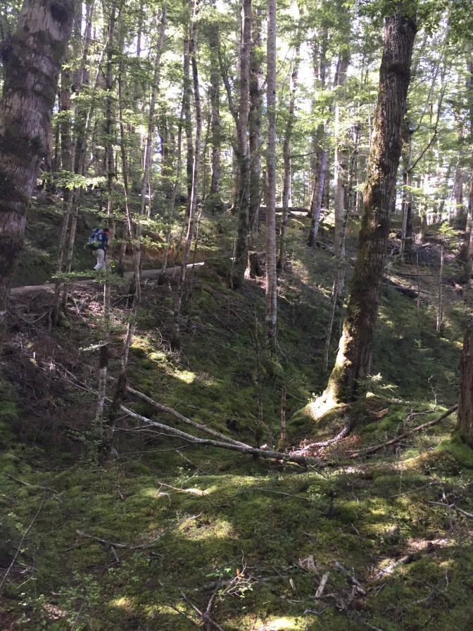
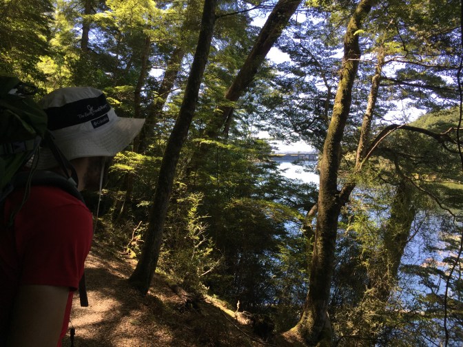
After breakfast we set off along the shore of the lake back to the main trail. At this point we were both pretty sore and ready to be done with all this walking. It took us about an hour of winding our way through more fuzzy beech forest to get to Rainbow Reach. In spite of today’s portion of the trail looking like a gradual downhill on the elevation profile in the DOC brochure, there were still a maddening number of switchbacks to trudge up and down. I suppose when the graph is measured in 250 meter increments a series of 100 foot ups and downs could look almost flat.

The fuzzy forest continued on even more monotonous than the previous day, though every now and then there were some nice views of the river. It was pretty torturous going through essentially the same scene hour after hour. Fortunately it wasn’t much longer until we ran into another group of walkers that were making their way from the hut. We stopped to chat for a minute. They had heard varying reports of how long it was to the end of the trail from hikers coming in the other direction. The shortest estimate was twenty minutes. We crossed our fingers and set off down the trail.
Sure enough we rounded the next bend in the trail and we could see the Te Anau control gates ahead on the river (this is where the trail started)! With that special burst of renewed energy that comes with the sight of your destination, we took off towards the end. Everything was great after that. Our spirits were high and our feet light as we practically floated back to the parking lot and our car. There is something different about hiking in a circuit as opposed to a one way tack. Our previous two hikes had us waiting around for transportation back to town, but this time we were right back where we started, all on our own.

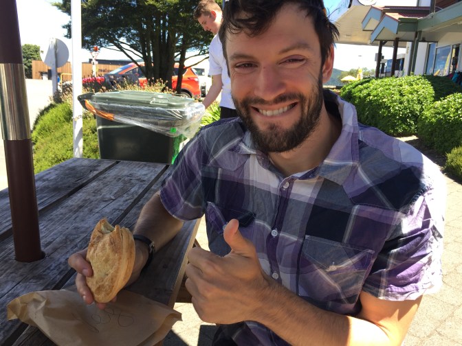
I swapped my boots and shirt for some clean clothes in a flash. No words were spoken regarding our next destination. We both knew exactly where we were going. The air in the car was positively electric with anticipation as we drove from the car park back into town. We pulled into a spot on the side of the road right in front of the legendary Miles Better Pies! I’m happy to say it was just as good as the first time. It was so good I could have eaten two, but then the ensuing food coma would have rendered me incapable of making the drive back to Queenstown.
The drive was painfully slow. “NZ roads are different. Allow extra time.” say the signs posted along the road, on bus shelters, in public restrooms, etc. And it’s true. The roads here are very narrow. Even the state highways are usually only one lane in either direction. In addition to this they are often windy and steep. If you get stuck behind a slower moving car (say an RV doing 20km/hr under the speed limit) it might be a while before you have a chance to pass them, even more so if there’s several of them in a row. Generally when Alana and I are planning a long road trip we take whatever time Google maps gives us and add an extra hour to get a more realistic estimate. There are a lot of slow RVs around here.

We stopped for dinner in Queenstown and got breakfast for the next day at PAK’nSAVE. Then we had another two hour drive to the campsite on highway 8 where we would spend the night. It was close to 9:00 when we arrived, but it was pretty light out. The campsite was next to a river on a wide plain surrounded by mountains in the distance. The howling wind and rocky hard ground made setting up the tent more difficult than usual, but with our combined powers we made it work. We hopped into the tent and our sleeping bags to get out of the cold. The next day we had another four hour drive to get back to Christchurch. We’re now in Christchurch preparing for our next adventure: The Abel Tasman Coast Track! Stay tuned!