After we finished our wwoofing we decided to take a few days and do some sightseeing up in the most northern parts of New Zealand. We booked a few nights stay at a great AirBnb in Peria, a small town (intersection) up in the middle of nowhere. It was a perfect base to explore the area.
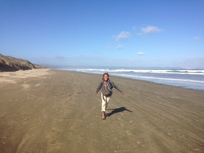
We set out the morning after our arrival and made our way over to the west coast and our first stop: 90 Mile Beach. This beach (which is actually only 88 kilometers) stretches along the very northwestern tip of the northwestern most peninsula of the North Island. The beach is actually a national highway, and at low tide you can drive the entire length on the sand. It is recommended that you have 4 wheel drive, and you do need to time the tides carefully to avoid getting caught by the rising water (which apparently happens somewhat often).
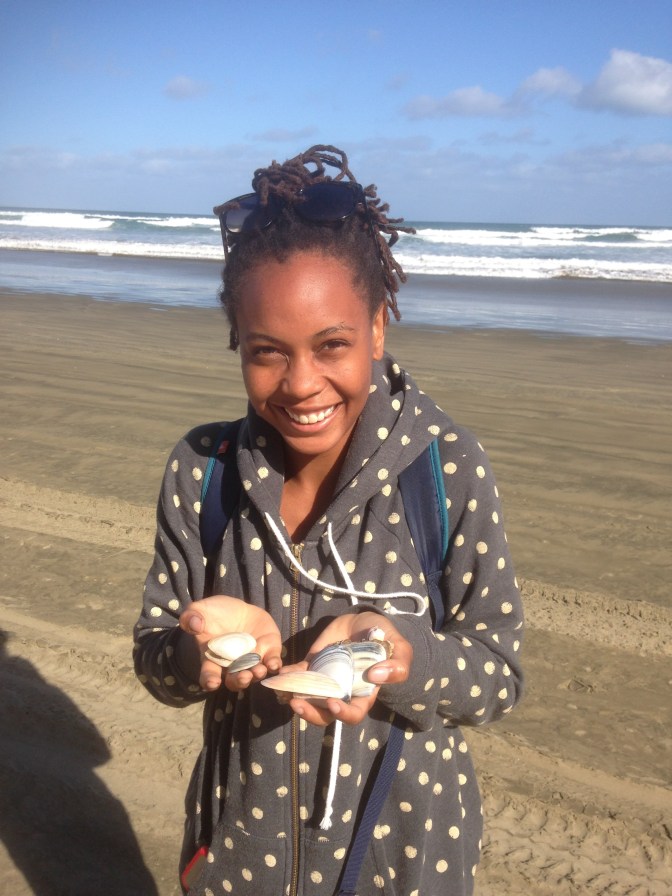
Considering the age of our car and its two wheel drivedness we decided not to attempt the drive and instead parked at the entrance and went for a short walk along the beach. It was a very nice day. We walked over the sand dunes and on to the beach. The beach stretched out endlessly to our right. It was really windy and the waves were constantly crashing against the shore. We wandered for a little while looking at shells that had washed up before we made our way back to the car.
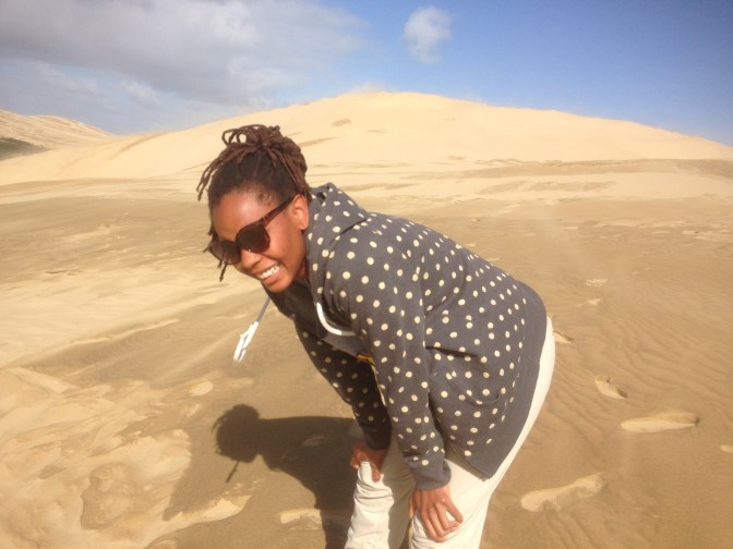
We continued making our way up north to the north end of 90 Mile Beach to our next destination: the Te Paki Sand Dunes. I thought the sand dunes at 90 Mile Beach were pretty cool, but I was completely blown away by these dunes. Te Paki Sand Mountains would have been a more appropriate name in my opinion. We got out of the car and the dunes towered a short distance away.
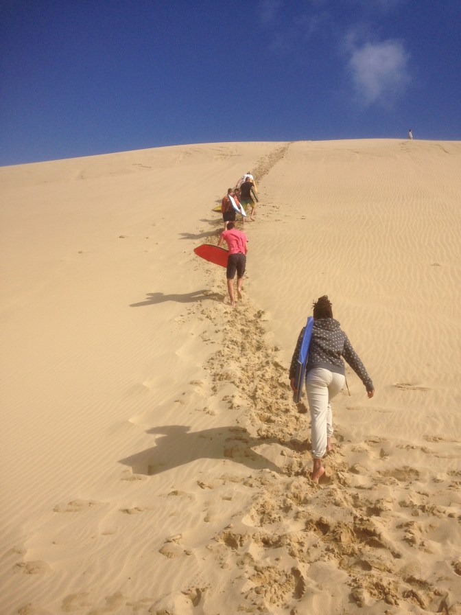
The dunes themselves were majestic and would have been worth the trip just to see, but of course there was more to do here. For $15 (only $10 if you thought to stop along the highway on the way out at the places advertising sandboards) you could rent a boogie board and walk up to the top of the dunes and ride it down! Alana and I got a board to share and started our walk up to the top of the dunes. We had to cross a small stream and a wide flat sandy area before we reached the first hill. There was a line of people making their way to the top so we hopped in. We weren’t even halfway up before we needed to stop and catch our breath, our legs burning from the effort. Every step we took our feet sunk down almost to the level that they were at before. I like to think I’m in pretty good shape, but I was completely winded by the time we got to the top.
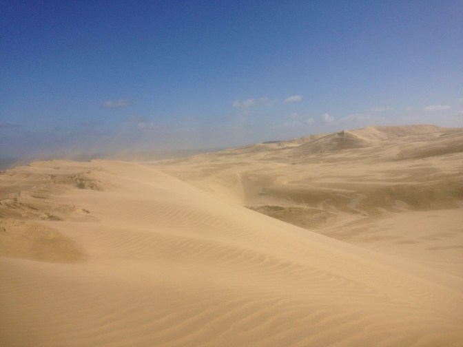
After catching our breath we headed off to another higher hill beyond this first one. Fortunately the climb wasn’t as steep. From the top you could see all of the dunes as well as the ocean. It was extremely windy and sand was blowing all over the place, so I couldn’t really admire the view. I had to hold the boogie board up in front of my face to keep the sand out of my eyes. I pulled out my camera, barely managing to hold on to the boogie board with one hand as I took some pictures.
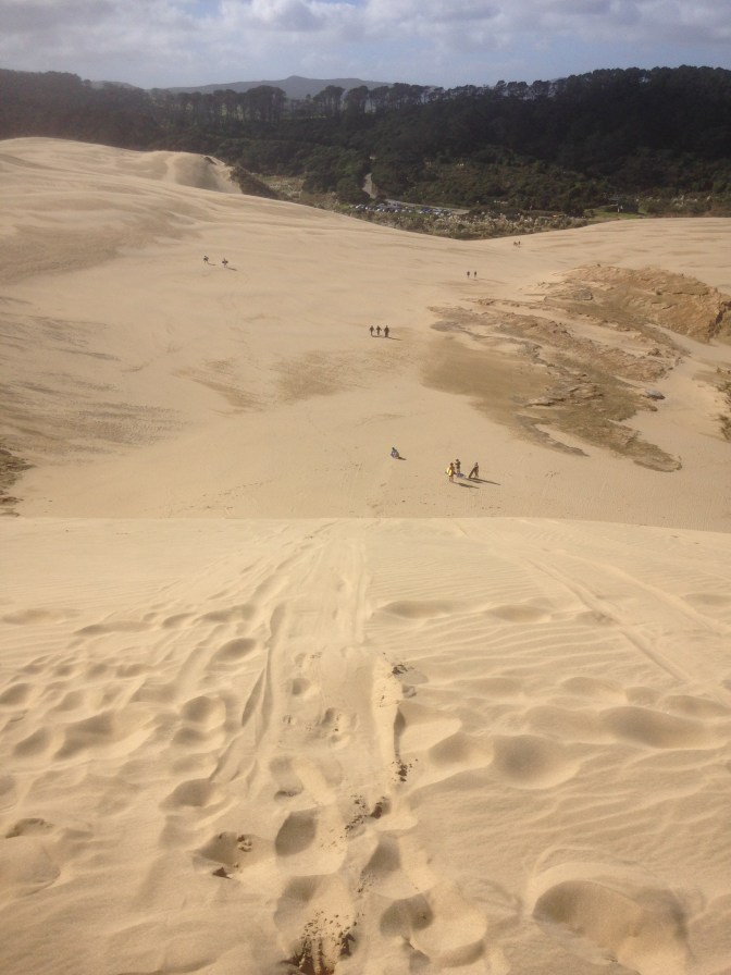
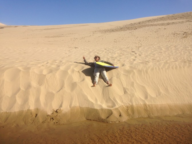
This first hill wasn’t really that steep and I was a bit underwhelmed by the ride down. Next Alana took a turn and she felt the same. After that we made our way back to the big hill that we had initially climbed up. This one was much longer and steeper than the previous. I went down first. It was much faster and more exciting. Then I had to trudge all the way back up the hill to give the board to Alana. I walked back down the way I came up (much easier going down) so I could take some pictures of Alana as she rode down.
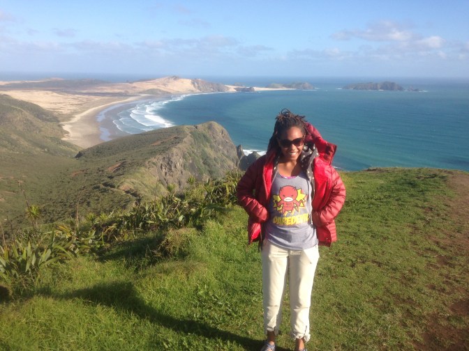
After that we were both too tired to even think about making another trip up the hill so we walked back to the parking lot and left for our third destination: Cape Reinga. Cape Reinga is the Northwesternmost tip of New Zealand. It is often thought of as the northernmost point in the country, but there is actually another small bit just off to the east that sticks up a little farther. Traditionally in Maori culture, it is the place where the spirits of the deceased would depart for the afterlife. There is also a lighthouse that was built in the 40’s.
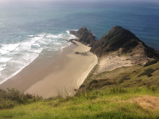
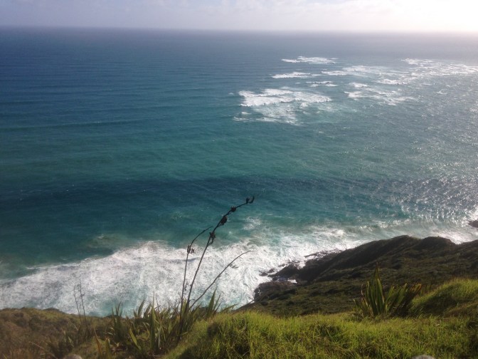
The scenery there was really incredible. There were steep cliffs that dropped down into the ocean on all sides. You could also see the point where the Tasman Sea and the Pacific Ocean meet, causing the water to crash and churn.
After such an action packed day we were pretty tired and headed back to Peria for a good nights sleep before heading back south towards Auckland.